


If February has felt dreary, there is good reason.
Precipitation in one form or another has been recorded on 19 of the month's 23 days so far, and the rain that's expected this weekend will not only continue the trend, but could push the month's totals toward record-setting realms.
That's already the case in Wheeling, W.Va., where the 5.76 inches of precipitation -- including the liquid equivalent of any snowfall -- has already broken a record that's stood since 1878. In Zanesville and New Philadelphia -- two Ohio towns included in the National Weather Service's Pittsburgh forecast area -- precip totals for this February are already in the top 10 since records have been kept.
And at Pittsburgh International Airport, where official weather data is collected, the 5.96 inches of precipitation that's fallen through Thursday places February 2018 in fourth place of the wettest Februarys of all time. And given that we're just 0.56 of an inch behind the record, set in 1887, it seems like a good bet that this month will be a record-breaker.
RECORD Monthly Precipitation for February:
— NWS Pittsburgh (@NWSPittsburgh) February 23, 2018
As you know its rained a lot this month. Several of our sites will be close if not establish a new record monthly rainfall for Feb. #Wheeling already has! #pawx #ohwx #wvwx #rain pic.twitter.com/jJ0XEqOs7X
"Actually, I'd think there's a good chance we'll break that record by (Saturday) morning at the latest," said Lee Hendricks, a meteorologist in the National Weather Service's office in Moon. "And if we don't by then, we'll get it by Sunday morning."
Mr. Hendricks said to expect just short of an inch of rain by Saturday morning; an additional 1.5 inches could fall before the rain ends on Sunday.
"We're just in this pattern, where we see this series of disturbances coming up from the southwest, with warmer, really moist air," he said. "The warmer temperatures have been kind of nice, but we just haven't been able to escape the rain."
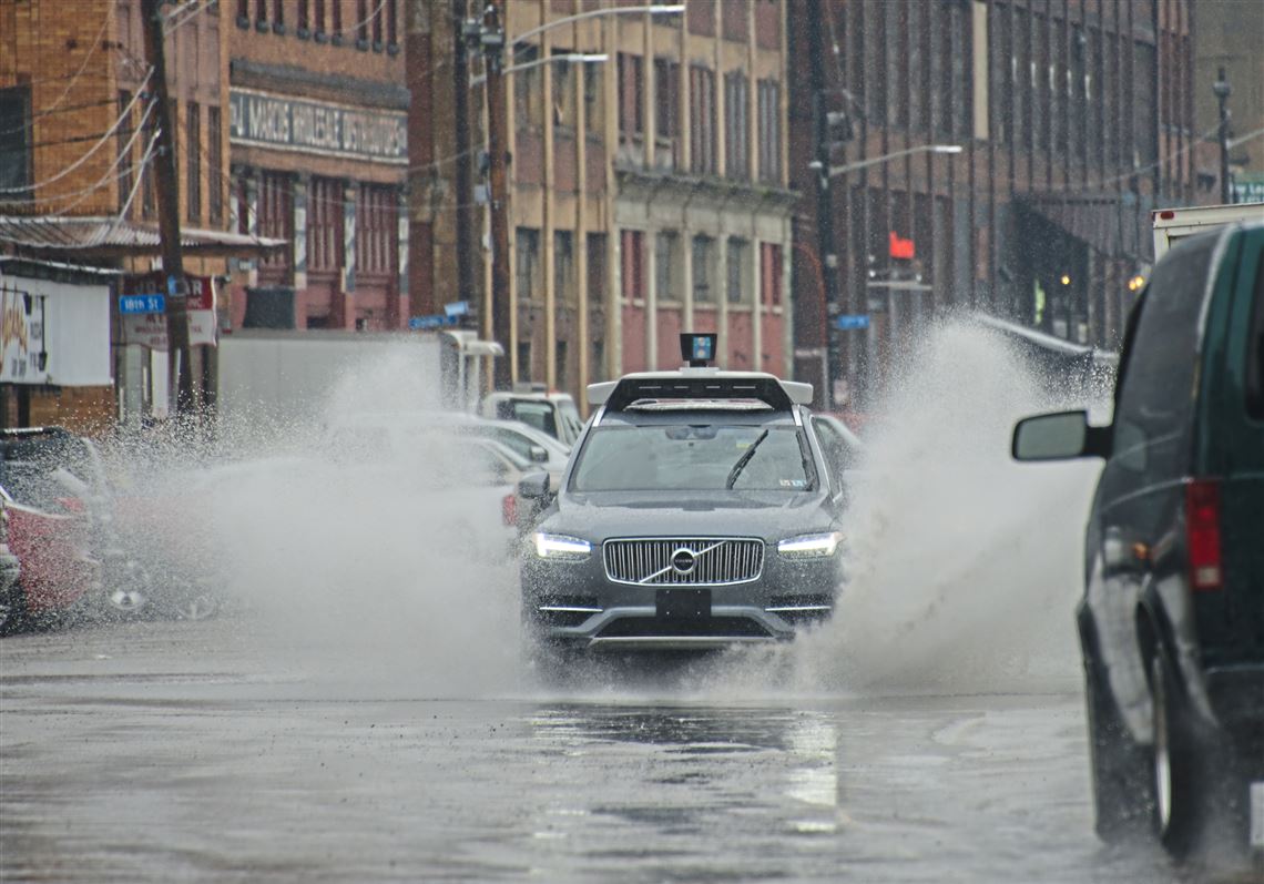
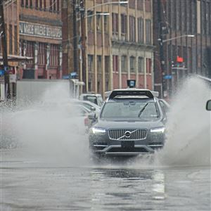
Mr. Hendricks was blunt in his assessment about flooding problems this weekend: saturated ground and streams and rivers that are already filled to the brim mean all that rainfall won't have anywhere to go. In addition to flood warnings and advisories for the region's rivers, the weather service has also issued an areal flood watch for the region, meaning those living or working in flood-prone areas or those driving near them should be prepared to take action if waters rise.
City officials in Pittsburgh are taking action already. The city said Friday morning that it would close bicycle lanes along Penn Avenue Downtown to allow Pittsburgh Allegheny County Thermal heating company to deploy pumps to protect its underground assets in the area; if the pumps are used, further closures along Penn and Fort Pitt Boulevard could be necessary.
In a release, it also said motorists should watch for flood-related closures along River Avenue on the North Shore, Washington Boulevard and the bathtub section of the Parkway East. The 10th Street Bypass and the Mon Parking Wharf are already closed.
Mr. Hendricks said we'll get to dry out for a bit after the rain ends on Sunday.
"I'm pretty confident we'll break the precipitation record, but next week isn't looking bad," he said. "The best part is that we may end it with three straight dry days."
Since Oct 1: you can see the departure from normal of precipitation is near the top end of the scale for parts of our region. #flood #pawx #wvwx #ohwx pic.twitter.com/m5gk4iLOUU
— NWS Pittsburgh (@NWSPittsburgh) February 23, 2018
First Published: February 23, 2018, 5:38 p.m.
Updated: February 23, 2018, 5:42 p.m.