


In a year that saw little snowfall, a record number of tornadoes, devastating flooding early and drought conditions late, Pittsburgh can add one more extreme to its 2024 weather recap: the warmest year on record.
The average temperature was 56.4 degrees, 1 degree higher than the previous record, set in 1921, according to the National Weather Service.

But that might undersell the true extent of Pittsburgh’s warmup — prior to 1948, the official temperature was recorded in Downtown, where the city’s industrial output and building density likely raised temperatures artificially, according to NWS Pittsburgh meteorologist Rich Redmond. Today, the NWS records temperatures at Pittsburgh International Airport.
Though 2024 is now the warmest, the next six warmest years on record were between 1881 and 1931, during the city’s industrial revolution. Records go back more than 150 years.
Mr. Redmond said the warming — and many of the other extreme events in the region recently — has “everything to do with climate change.”
“You can look at all the data you want, go back as far as you want — our climate is continuing to warm,” he said.
Pittsburgh’s record wasn’t unique: 2024 was also the hottest year on record for Earth, according to the World Meteorological Organization.
Seasons’ heating
Pittsburghers likely remember a searing summer. The average temperature from June to August was 74.4 degrees, the highest in almost 30 years, according to the NWS. The highest temperature of the year at the NWS’s official recording site was 94 degrees, reached on seven different days. In 2023, temperatures never eclipsed 91 degrees.
But the biggest departures from historical averages actually occurred in other seasons. The year produced Pittsburgh’s fourth-warmest winter (December 2023-February), all-time warmest spring (March-May) and sixth-warmest autumn (September-November).
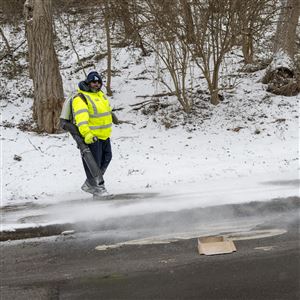
The warm winter contributed to one of the lowest snowfall totals in Pittsburgh history. The 2023-24 snow season saw just 16.3 inches, a far cry from the 44.1 inches the region averaged from 1991 to 2020.
“When we redid the normals from 1991 to 2020, every season has seen a warmup, but the biggest warmup we have seen has occurred in the winter months,” Mr. Redmond said.
Temperatures haven’t dipped below zero since December 2022.
Other impacts
Extreme heat alone can be deadly — it caused an estimated 2,302 deaths in the U.S. in 2023, according to the Centers for Disease Control and Prevention. Friederike Otto, an Imperial College London climate scientist, called heat waves “by far the deadliest extreme event.”
In addition to warmer temperatures, Pittsburgh is also seeing higher humidity, which can raise the heat index — or “feels like” temperature — to dangerous levels.
Still, the area has relatively cooler summers compared to much of the world, and Pittsburgh-area residents likely won't have too many complaints about the warmer winters. But the risk of potentially devastating effects from climate change persists, Mr. Redmond said.
“As the climate is warming, we're also seeing more extreme events,” he said. “We're seeing more devastating floods. We're seeing stronger thunderstorms, more tornadoes.”
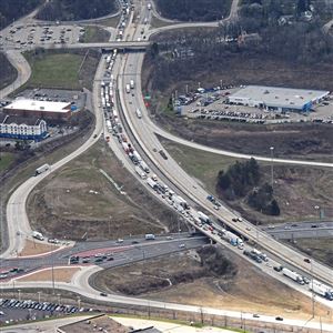
Western Pennsylvania saw those extremes in last year’s volatile precipitation pattern. After nearly setting a rainfall record in April — which triggered pockets of devastating flooding in towns across the region and the highest river crest in Downtown Pittsburgh since 2005 — the area had its driest summer and fall since 2002, leading to widespread drought conditions.
“We went into spring … well above normal precipitation,” Mr. Redmond said. “But then all of a sudden, the spigot turned off, and in June, July and August and into the fall, we saw a drought arise very quickly.”
Pittsburgh finished the year more than 4 inches above its average precipitation despite that extended dry period.
It is official, 2024 was the warmest year on record for Pittsburgh, PA. The average mean temperature of the year was 56.4°F. The previous record was 55.4°F in 1921. pic.twitter.com/6686PFqS3Q
— NWS Pittsburgh (@NWSPittsburgh) January 2, 2025
Changes in 2025?
Temperatures plummeted as the New Year began and are expected to remain low for much of early January. But it’s just a return to historical averages, according to NWS Pittsburgh meteorologist David Shallenberger.
“We may think it might be cool,” he said. “But from a lot of values we've been seeing, it's actually been normal.”
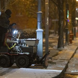
Projections for the winter show lower-than-normal snowfall, but Mr. Shallenberger said between now and the middle of January might produce the most snow and lowest temperatures of the winter.
After receiving a few inches of snow Friday while under a winter weather advisory, Pittsburgh could get more snow Sunday into Monday.
First Published: January 4, 2025, 10:30 a.m.
Updated: January 4, 2025, 8:01 p.m.