


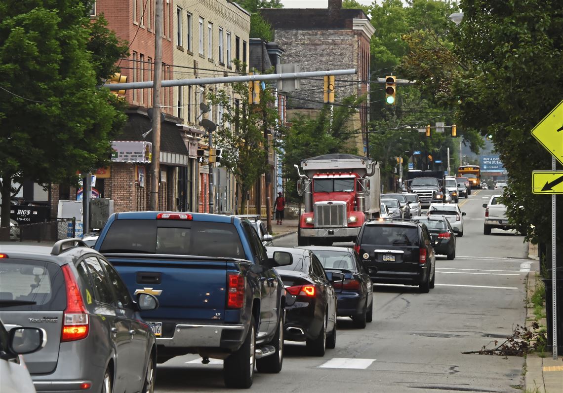

The problem is easy to identify: How to ease congestion through Pittsburgh’s busy Second Avenue corridor, especially with development at the Hazelwood Green site.
The Southwestern Pennsylvania Commission is in the midst of an eight-month study to determine how to better move people between the Armstrong Tunnel and the Glenwood Bridge over the next 20 years. It will use a number of elements — improved transit, bike lanes, better sidewalks — to come up with answers.
The commission began the Second Avenue Multimodal Corridor Study in November on behalf of the city, the Pennsylvania Department of Transportation, the Port Authority and Allegheny County and expects to release the results in early summer.
The corridor’s diversity adds to the challenge. From the tunnel to the bend at Greenfield Avenue, the roadway runs below the Parkway East on one side with mostly industrial property on the other, but from there to Glenwood, it is much more residential on both sides.
Traffic is congested now, and the industrial area could add 6 million to 8 million square feet of development on the Hazelwood Green site that once housed the Jones & Laughlin steel plant.
“We’re looking at how we can encourage more modal uses in that area besides cars,” said Domenic D’Andrea, manager of transportation operations and safety programs for the planning group. “We’re trying to get feedback any way we can. We’re all ears at this point.
“All of that is going to provide us a picture of the current conditions.”
The agency’s outreach will include community meetings — the first of four was held last month — and a website, https://spcsecondavenue.com/. The website features a survey through March 13 with 29 questions designed to find out how people use the corridor and an interactive map so participants can click on specific areas and add concerns.
Everyone involved concedes it would be difficult to add more vehicles to the corridor, Mr. D’Andrea said, so the study is considering how to expand alternatives.
Adding transit, including the city’s proposed electric shuttle linking Hazelwood with Oakland via Schenley Park and the concept of solar-powered vehicles from its Second Avenue parking plaza to Hazelwood Green, would be one method of reducing cars in the corridor. Others would include adding bike lanes and improving sidewalks so pedestrians can move easily through the area.
The city also is developing Second Avenue as one of eight “smart spines” in the city with adaptive traffic signals designed to help move traffic.
Todd Kravitz, PennDOT’s district traffic engineer, said the study also will consider how parallel streets in Hazelwood might be used as alternative routes through the corridor. He called improving sidewalks and side streets “low-hanging fruit” that could be implemented quickly and inexpensively.
“That’s what we’re looking at: What sorts of strategies can we hope to use with the least amount of impact,” Mr. Kravitz said.
Mr. D’Andrea said the study to identify solutions should be done by the end of June, but then the harder work begins.
“The issue isn’t finding the solutions,” he said. “It’s funding the solutions.”
Pittsburgh is responsible for the roadway from the Armstrong Tunnel to Bates Street, but from there to the Glenwood Bridge it is maintained by PennDOT. Bates Street also is part of the study.
Ed Blazina: eblazina@post-gazette.com, 412-263-1470 or on Twitter @EdBlazina.
First Published: March 4, 2019, 11:48 p.m.
Updated: March 5, 2019, 12:38 a.m.