


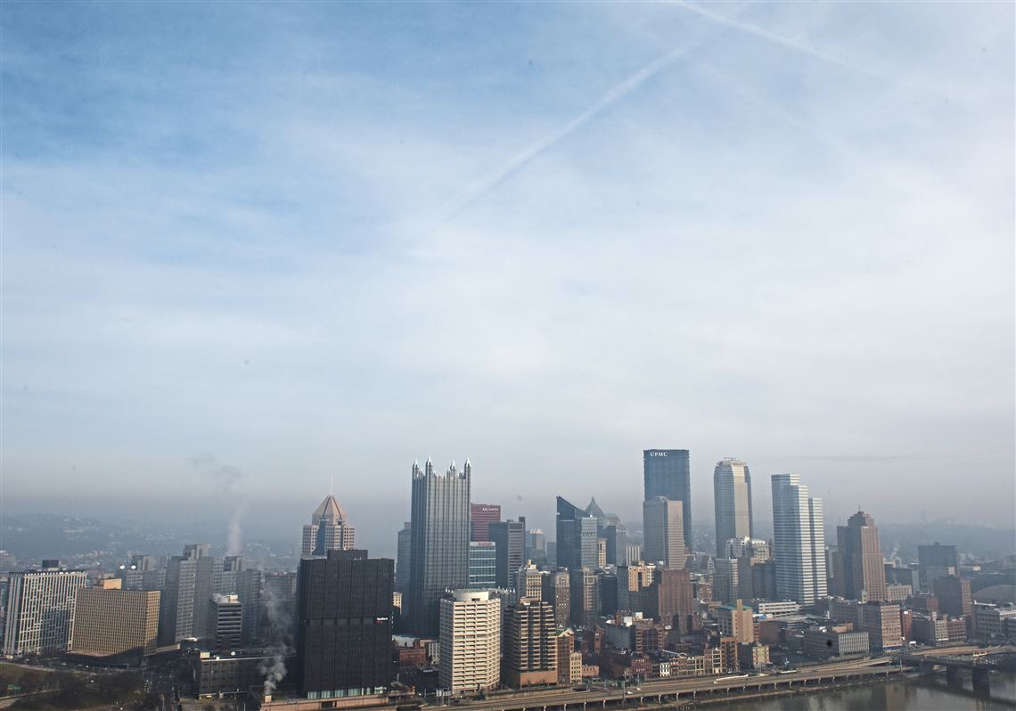
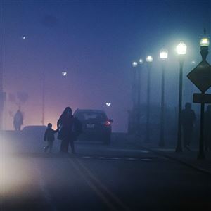
The pea-soup fog — or in Pittsburgh, maybe more like wedding-soup fog — that socked in the region Christmas Eve and morning, disrupting airline travel and making driving conditions challenging, had mostly disappeared by Wednesday afternoon with warmer temperatures and clearer skies forecast.
“It's a slow burnoff," Evan Bookbinder, a meteorologist with the National Weather Service in Moon, said Wednesday morning.
Warm temperatures are expected for Christmas Day. Fog will burn off during the morning hours, with decreasing cloud cover through the day. Highs in the upper 40s to mid 50s. pic.twitter.com/Ih0OkxQLC6
— NWS Pittsburgh (@NWSPittsburgh) December 25, 2019
Mr. Bookbinder couldn’t help but marvel at the impressive dense fog that shrouded a wide swath of southwestern Pennsylvania. He said visibility was close to zero Tuesday night.
Anecdotally, he said it was “one of the densest fogs that we’ve ever seen,” rivaling the marine fog he said he saw while growing up along the Atlantic Ocean. Driving on the highway to and from work, he measured the visibility at only “one dash,” referring to the white dashed lines separating lanes.
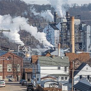
Caused by a temperature inversion, the weather phenomenon resulted in limited visibility, led to numerous flight delays or cancellations and caused unhealthy air because of pollutants trapped at ground level.
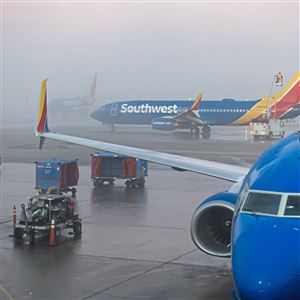
On Tuesday, 18 flights scheduled to arrive at Pittsburgh International Airport had to be diverted because of the fog, and 35 departures were canceled, according to Bob Kerlik, an airport spokesman. No arrivals had been diverted as of late Wednesday morning, and the majority of flights were departing.
The foggy area stretches in the north from Erie to Butler, to the eastern suburbs in Westmoreland County, and across the West Virginia panhandle to the eastern third of Ohio, Mr. Bookbinder said.
While folks along Interstate 80 in the east, such as DuBois, Clearfield County, and south in Morgantown, W.Va. enjoyed clear conditions and “have no idea what we’re talking about,” to the west and north of those locations, people have found themselves “in the soup,” according to Mr. Bookbinder, or, as he scientifically put it, the “dense fog blob.”
The state Department of Environmental Protection had predicted a “Code Orange air quality action day” for the region on Wednesday, due to high amounts of fine particles in the air and a temperature inversion plus low wind speed that will trap the pollutants at ground level, particularly in the Mon Valley but extending beyond it. Much the same conditions could persist through Thursday.
The temperature inversion, which occurs when a layer of warm air overrides a layer of cooler air, is resulting from a stagnant high pressure system.
Mr. Bookbinder said while it was 28 degrees earlier Wednesday morning at ground level, it was 50 degrees 1,000 feet up.
“That’s impressive,” he said.
As the fog burns off, temperatures will skyrocket, shooting up seven to 10 degrees in an hour, according to Mr. Bookbinder. Temperatures will vary across the region by late Wednesday, with areas that had been hemmed in by fog, such as Pittsburgh, hitting the low to mid-40s, while areas that had been clear seeing numbers in the 50s.
Mr. Bookbinder said it will likely stay dry and warm for the next few days.
First Published: December 25, 2019, 3:48 p.m.
Updated: December 25, 2019, 6:19 p.m.