


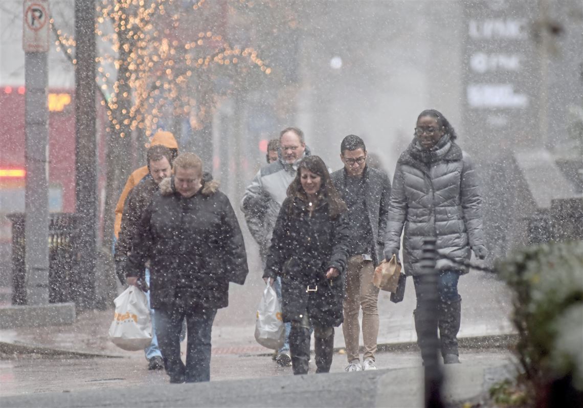
National Weather Service meteorologists in Pittsburgh are closely watching a storm system headed our way that could dump some significant amounts of snow this weekend — depending on how it tracks.
The weather service’s Lee Hendricks said the weather models for a Saturday-into-Sunday event are so iffy that local meteorologists are hesitant to predict snowfall totals. The slightest shift could mean the difference between 1 inch and 6 inches of the white stuff.
“Location is everything on that. It may track further south and that may mean more snow than rain” for the Pittsburgh area, Mr. Hendricks said Wednesday. “We have no confidence in any of the snowfall amounts at this point.”
So far, he noted, it looks like we’ll start out with some snow Saturday morning before a changeover to rain, sleet and snow in the afternoon. The temperature will peak in the mid-30s.
A blockbuster storm will unleash heavy snow, ice and fierce winds across northeastern US this weekend. Some areas can expect over a foot of snow: https://t.co/x4ZcnKcGy2 pic.twitter.com/GEU84TyLFD
— AccuWeather (@breakingweather) January 16, 2019
Evening hours will see mostly sleet, with rain and snow overnight into Sunday morning. That’s also when temperatures begin plummeting into the teens. But Sunday night will feel more bitterly cold when temps drop even further — to around 0 with wind chills of minus-15 degrees, Mr. Hendricks said.
Thursday-Friday
The region will see its first wave of precipitation arrive by Thursday afternoon with an inch or less of snow forecast. Temperatures are expected to hover around the freezing mark.
“It’ll be a mixed bag going on here during the daylight hours but not that much accumulation. We’re not looking at anything really significant,” Mr. Hendricks said. “The center of the system will pretty much pass right over us.”
Heaviest precipitation will fall by Friday morning before gradually ending later in the day. The high will be near 36 degrees.
The weaker of two winter storms will spread a swath of snow and wintry mix from the Midwest to parts of the Ohio Valley and Northeast from Wednesday night into Friday before the second brings heavier wintry precipitation to the region this weekend: https://t.co/WDlg7diQGO pic.twitter.com/9GA5IkQL2s
— AccuWeather (@breakingweather) January 16, 2019
Here is the latest snowfall forecast for Thursday night into Friday. There is still a lot of questions regarding the weekend weather system, so amounts for that time frame won't be out until late Thursday or early Friday. pic.twitter.com/NkBIkSelr3
— NWS Pittsburgh (@NWSPittsburgh) January 15, 2019
First Published: January 16, 2019, 11:05 a.m.
Updated: January 17, 2019, 12:32 p.m.